The Map view presents geospatial and timeline information stored for map documents:
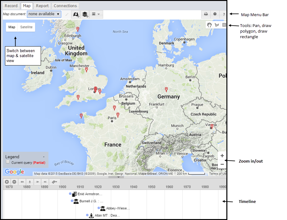
If a record has either or both location (geospatial) and timeline (temporal) date, this information will appear on the Map section and in the TimeLine section, as appropriate. The map and timeline will update as the selection is changed (i.e. records selected/deselected).
Note. Data will only appear on the map if geographic objects are included in the record. An empty or sparsely populated map will be generated if the search results do not contain any map data.
Note. The number of records shown in the Map View is limited by the number set in your profile. By default this is 500 (i.e. data for only the first 500 records is displayed). Google Maps and VIS Timeline do not work well with large number of objects, and may hang your browser or cause it to report the page as non-responsive. We recommend refining your filters to retrieve fewer records before mapping. You may also change the record limits for map and timeline in Profile | My Preferences.
The following additional options are available from the Menu (top-right of tab):
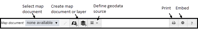
To create and use 'map documents', see Define a Map Document.
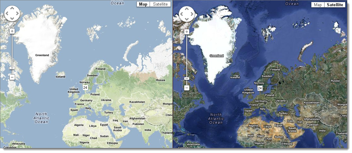
You can toggle between a Map view and Satellite view by clicking on the appropriate Map/Satellite button at the top-right of map:
To embed a map in a web page, select Menu | Embed Map Code:
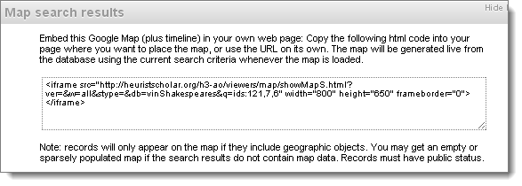
Copy the code generated into the web page where the map is to be placed. The map will be generated live from the database using the current search criteria, and this reflects the latest changes to the database.
Created with the Personal Edition of HelpNDoc: Generate Kindle eBooks with ease